sport.wikisort.org - Stadium
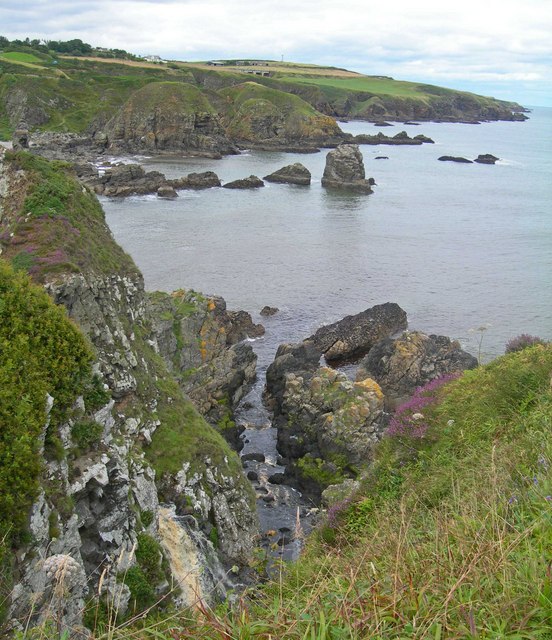
Doonie Point is a rocky headland situated approximately 1.5 kilometres south of the village of Muchalls in Aberdeenshire, Scotland.[1][2] The clifftop of Doonie Point yields views to the north of Grim Brigs, Brown Jewel and the coast of Newtonhill. To the south are views of the Castle Rock of Muchalls and the rugged North Sea coastline toward Stonehaven. Notable historic structures in the vicinity of Doonie Point are the Chapel of St. Mary and St. Nathalan, Muchalls Castle and the Mill of Muchalls. This site is a recognised rock climbing venue.[3][4] Doonie Point is catalogued within the marine rescue activities for this part of the coast of northeast Scotland.[5]
History
Doonie Point is slightly east of the ancient Causey Mounth trackway, which road was constructed on high ground to make passable this only medieval route from coastal points south from Stonehaven to Aberdeen. This ancient trackway specifically connects the River Dee crossing (where the present Bridge of Dee is situated) via Portlethen Moss, Muchalls Castle and Stonehaven to the south.[6] The route was that taken by William Keith, 7th Earl Marischal and the Marquess of Montrose when they led a Covenanter army of 9000 men in the battle of the Civil War in 1639.[7]
References

- Gazetteer for Scotland: Doonie Point
- Doonie Point geodata[permanent dead link]
- Rock climbing characteristics of Doonie Point
- UK Rock Climbing:Doonie Point, Aberdeenshire[permanent dead link]
- Marine rescue photographic survey of northeast Scotland coastline Archived 24 July 2008 at the Wayback Machine
- C.Michael Hogan. Causey Mounth, Megalithic Portal, ed. A. Burnham, 3 Nov. 2007
- Watt, Archibald, Highways and Byways around Kincardineshire, Stonehaven Heritage Society (1985)
This article related to Aberdeenshire, Scotland, is a stub. You can help Wikipedia by expanding it. |
This article about a Scottish sports venue is a stub. You can help Wikipedia by expanding it. |
Другой контент может иметь иную лицензию. Перед использованием материалов сайта WikiSort.org внимательно изучите правила лицензирования конкретных элементов наполнения сайта.
WikiSort.org - проект по пересортировке и дополнению контента Википедии